
Drones: habitat and landscape
Drones are producing a quantum leap in the study of landscape and habitat changes, because they permit to obtain aerial imagery on demand, with rather simple logistics, and with much lower cost than alternatives (manned aerial surveys, satellite imagery).
At Sea Lion Island we are using drones to document changes in habitat and landscape. We are particularly interested in ephemeral habitats like sand dunes and beaches, because they can show huge changes on a short time scale.
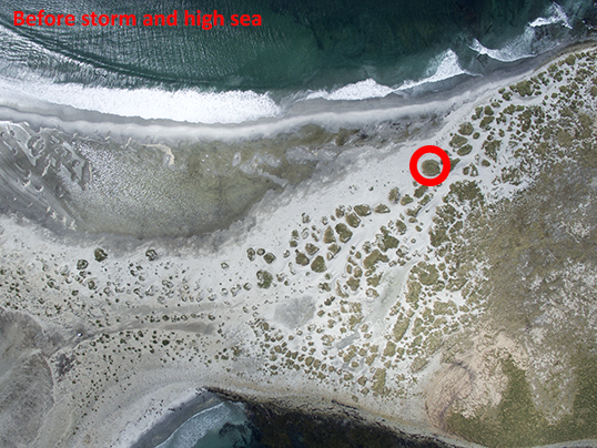
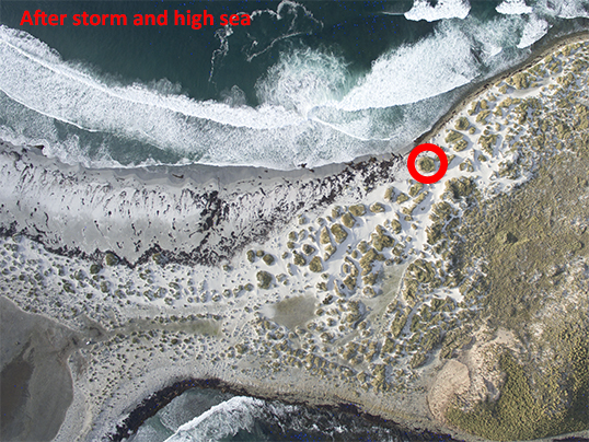
Sea Lion Island sand beach before and after a big storm; see the tussac dune of the red circle for reference
For more information please contact us by email at fil_esrg@eleseal.org. Thank you for your interest in our research projects !